Your search found 2334 photographs. Click to jump to detailed information about a particular catalogue entry. Not what you were looking for? See our search tips or search the catalogue again.
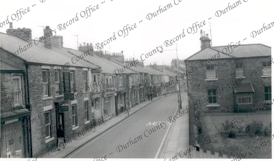
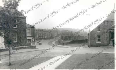
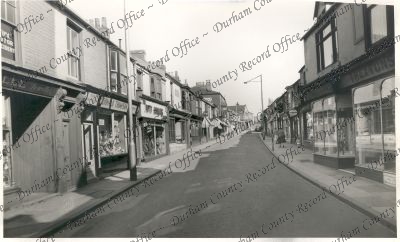
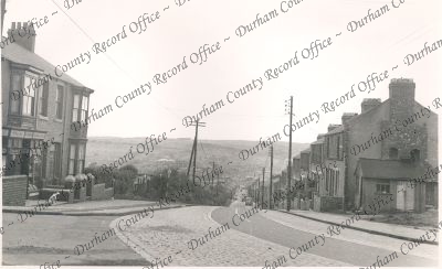
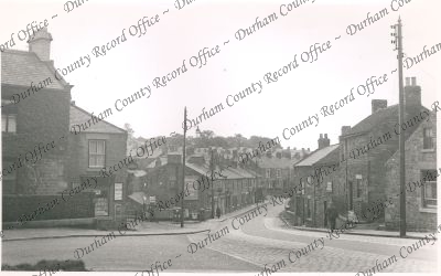
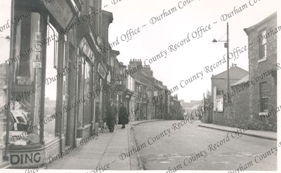
 Photograph of Crook, Hope Street: general street scene, n.d.D/CL 5/642
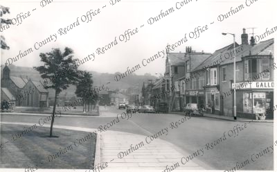
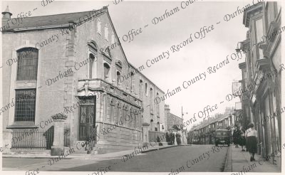
- Photograph of Crook, Church Street: general street scene, n.d.D/CL 5/643
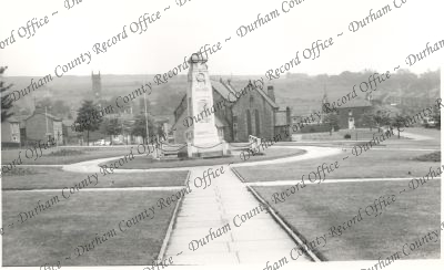
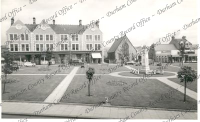
- Photograph of Crook, Memorial Green: view of memorial and surrounding buildings, n.d.D/CL 5/644
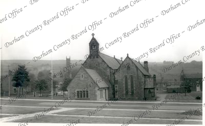
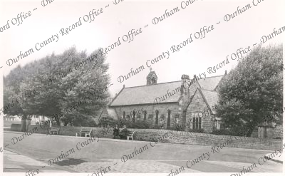
- Photograph of Crook: general view of St. Catherine's Parish Church, n.d.D/CL 5/645
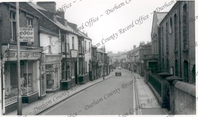
- Photograph of Crook, Church Street: general street scene, n.d.D/CL 5/646
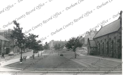
- Photograph of Crook, the green: general view of green and adjoining properties, n.d.D/CL 5/647
- Photograph of Crook, the green and North Terrace: view of the green, war memorial and adjacent properties, n.d.D/CL 5/648
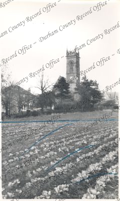
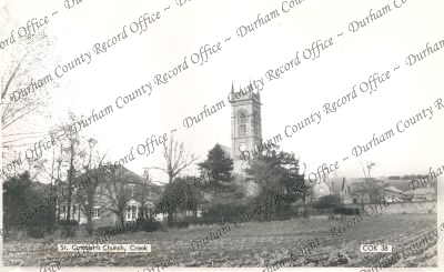
- Photograph of Crook, St. Cuthbert's Church: general view from cultivated field with church tower in background, n.d.D/CL 5/649
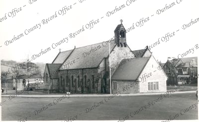
- Photograph of Crook, St. Catherine's Parish Church: oblique view of church and belfry, n.d.D/CL 5/650
- Photograph of Crook, St. Cuthbert's Church: view of church tower from agricultural land, n.d.D/CL 5/651
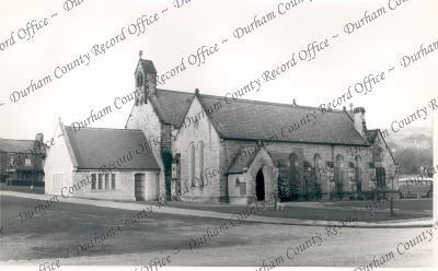
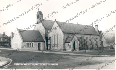
- Photograph of Crook, St. Catherine's Parish Church: view of frontage church, n.d.D/CL 5/652
- Photograph of Crook, St. Catherine's Parish Church: frontage of church, n.d.D/CL 5/653
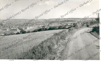
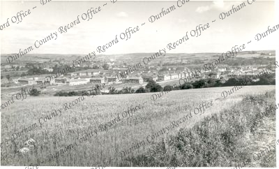
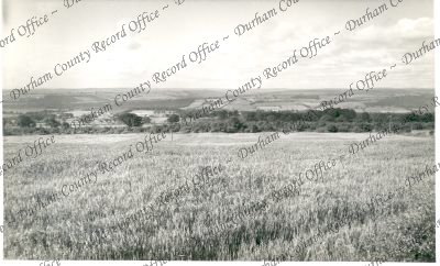
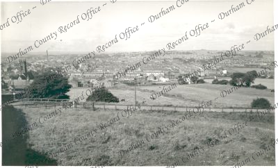
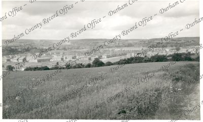
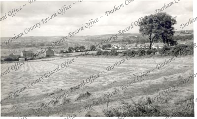
- Photograph of Crook, general view: overview of town from elevated ground, n.d.D/CL 5/654
- Photograph of Crook, general view: overview of town from elevated ground, n.d.D/CL 5/655
- Photograph of Crook, general view: overview of town from elevated ground, n.d.D/CL 5/656
- Photograph of Crook, Hope Street: street scene, n.d.D/CL 5/657
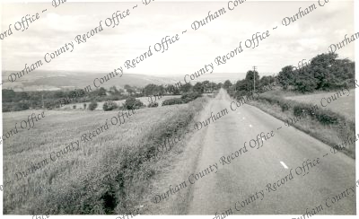
- Photograph of Crook, view from Wood Road: view of countryside from open road, n.d.D/CL 5/658
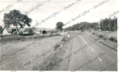
- Photograph of Crook, Harperley Gate: view of crossroads, n.d.D/CL 5/659
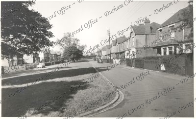
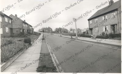
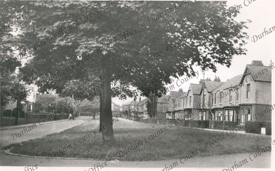
- Photograph of Crook, St. Mary's Avenue: view of residential properties, n.d.D/CL 5/660
- Photograph of Crook, West Road: general view, n.d.D/CL 5/661
- Photograph of Crook, view from Wood Road: general view of countryside, n.d.D/CL 5/662
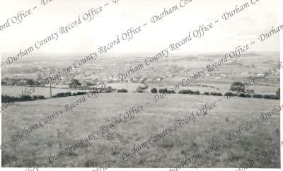
- Photograph of Crook, general view: overview of town from elevated land, n.d.D/CL 5/663
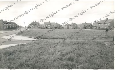
- Photograph of Crook, Mawn Meadow's Estate: view of properties adjacent to estate roads, n.d.D/CL 5/664
- Photograph of Crook, Watergate Estate: general view from elevated ground, n.d.D/CL 5/665
- Photograph of Crook, St. Mary's Avenue: general view, n.d.D/CL 5/666
- Photograph of Crook, general view: overview of town from high ground, n.d.D/CL 5/667
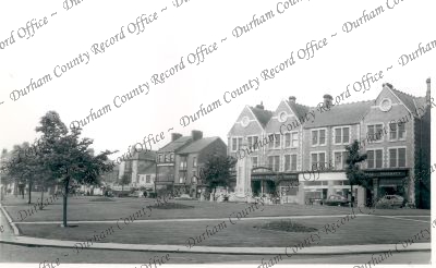
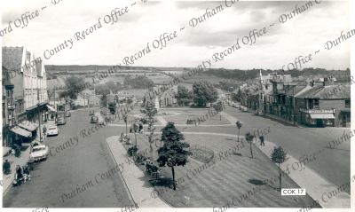
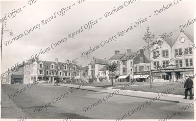
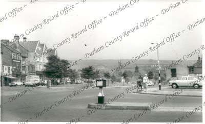
- Photograph of Crook, Market Place: overview of market place from elevated view point, n.d.D/CL 5/668
- Photograph of Crook, Market Place: view looking to the west, n.d.D/CL 5/669
- Photograph of Crook, Market Place: general view of green and war memorial, n.d.D/CL 5/670
- Photograph of Crook, Wheatbottom Bank: general street scene looking down bank, n.d.D/CL 5/671
- Photograph of Crook, Market Place: general view, n.d.D/CL 5/672
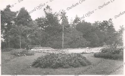
- Photograph of Crook, the park: view of trees and flower beds, n.d.D/CL 5/673
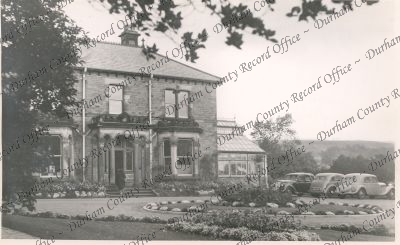
- Photograph of Crook, Glenholme, council offices: view of front building, n.d.D/CL 5/674
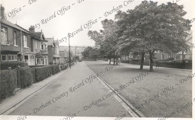
- Photograph of Crook, Durham Road: general street scene, n.d.D/CL 5/675
- Photograph of Crook: view of parish church from highway, n.d.D/CL 5/676
- Photograph of Crook, Market Square: general view, n.d.D/CL 5/677
- Photograph of Crook, the church, and memorial: view of St. Catherine's church looking towards the east, n.d.D/CL 5/678
- Photograph of Crook, Hope Street: street scene, n.d.D/CL 5/679
- Photograph of Crook, St. Mary's Avenue: general view, n.d.D/CL 5/680
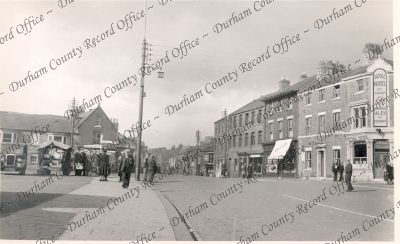
- Photograph of Crook, Hope Street: general street scene, n.d.D/CL 5/681
- Photograph of Crook, Hope Street: general street scene, n.d. (DR03681)D/CL 5/682
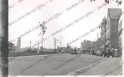
- Photograph of Crook, Market Place: view across road junction in an easterly direction, n.d. (DR03682)D/CL 5/683
- Photograph of Crook, Hope Street: general view, n.d. (DR03679)D/CL 5/684
- Photograph of Crook, Mawn Meadows Estate: general view, n.d. (DR03680)D/CL 5/685
- Photograph of Crook, Market Place: view looking westwards over Bishop Auckland and Tow Law road junction, n.d. (DR03678)D/CL 5/686
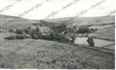
- Photograph of Cowshill, general view: view looking down on village from high ground, n.d.D/CL 5/687
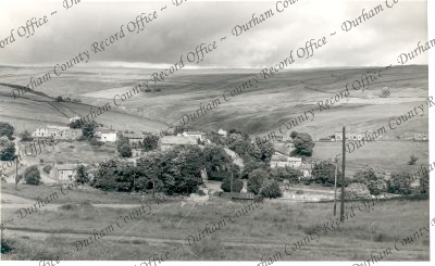
- Photograph of Cowshill, view from 'Bents': view looking down on village from hillside, n.d.D/CL 5/688
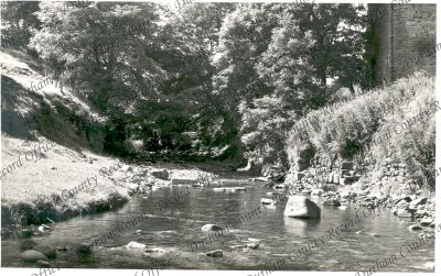
- Photograph of Cowshill, the river: general view at water level, n.d.D/CL 5/689
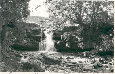
- Photograph of Cowshill, Burtree Falls: general view, n.d.D/CL 5/690
- Photograph of Cowshill, Lanehead: general view, n.d.D/CL 5/691