Your search found 17450 photographs. Click to jump to detailed information about a particular catalogue entry. Not what you were looking for? See our search tips or search the catalogue again.
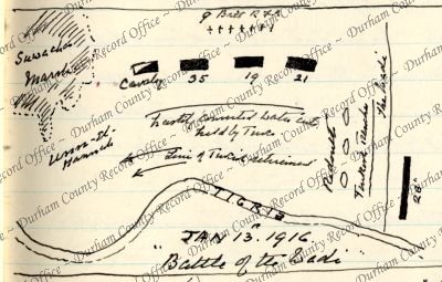
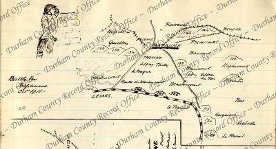
 Sketch map captioned Battle of the Wadi [Mesopotamia], 13 January 1916D/DLI 7/63/2(168)
- Sketch map captioned Battle of Umm El-Hannah [Hanna Defile, Mesopotamia], 21 January 1916D/DLI 7/63/2(169)
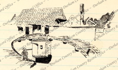
- Sketch of a tank in a ruined town, c.1917D/DLI 7/63/2(170)
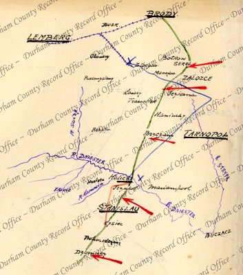
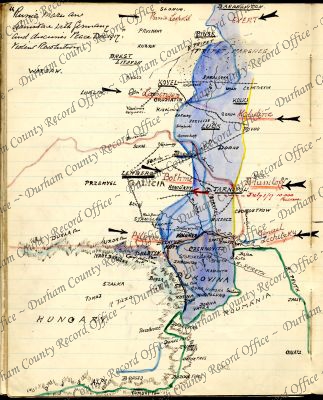
- Colour sketch map captioned 'Russia's Attack after the Revolution', showing Stanislau and Tarnopol on the Austrian Front, July 1917D/DLI 7/63/2(171)
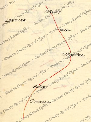
- Colour sketch map captioned 'Approximate Russian Line', on the Austrian Front, 25 July 1917D/DLI 7/63/2(172)
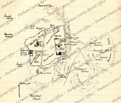
- Sketch map of Moriah and environs, Mesopotamia, c.1916D/DLI 7/63/2(174)
- Colour sketch map of the Western Front, c.1916D/DLI 7/63/2(175)
- Colour sketch map of the Western Front, 15 July 1916D/DLI 7/63/2(176)
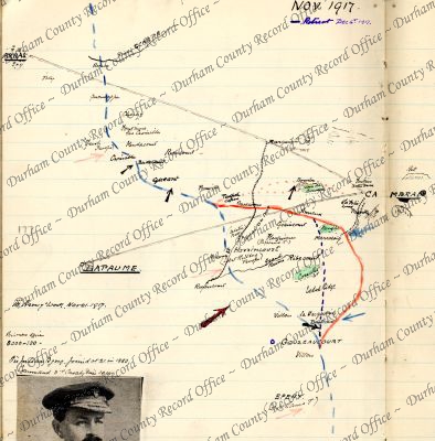
- Colour sketch map of the Western Front, November 1917D/DLI 7/63/2(177)
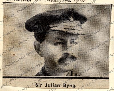
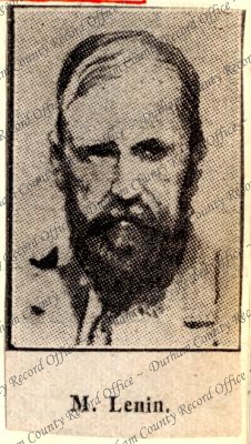
- Photograph, from a newspaper of General Sir Julian Byng, c.1914D/DLI 7/63/2(178)
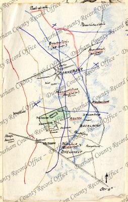
- Colour sketch map of Gheluvelt and Zonnebeke, Belgium, 4 October [possibly 1917]D/DLI 7/63/2(179)
- Colour sketch map of the Western Front around Zonnebeke, Belgium, c.1917D/DLI 7/63/2(180)
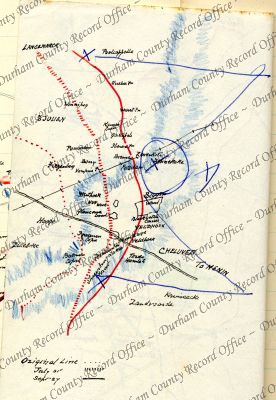
- Sketch map of Bourlon Wood, France, c.1917D/DLI 7/63/2(181)
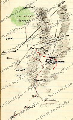
- Colour sketch map of Passchendaele and environs, Belgium, October 1917D/DLI 7/63/2(182)
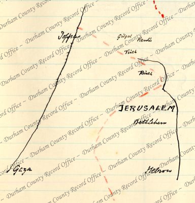
- Colour sketch map of Palestine, November 1917D/DLI 7/63/2(183)
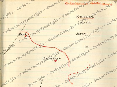
- Colour sketch map of Palestine, c.1917D/DLI 7/63/2(184)
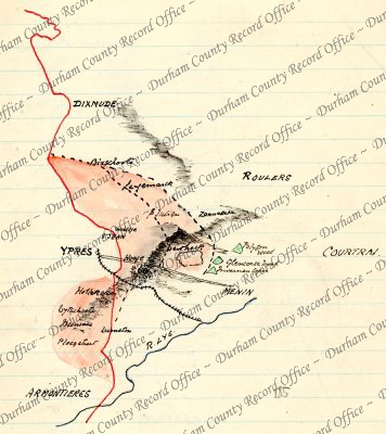
- Colour sketch map captioned iii Battle of Ypres [Belgium], July - August 1917D/DLI 7/63/2(185)
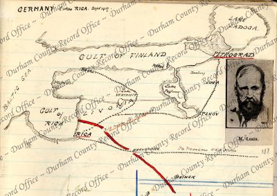
- Colour sketch map captioned Germany takes Riga [Livonia, Russia], showing a section of the Eastern Front, September 1917D/DLI 7/63/2(186)
- Duplicate of D/DLI 7/63/2(148)D/DLI 7/63/2(187)
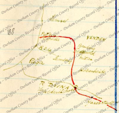
- Colour sketch map of a section of the Eastern Front around Riga [Livonia, Russia], c.1917D/DLI 7/63/2(188)
- Colour sketch map of the 'Baltic Line' on the Eastern Front, c.1917D/DLI 7/63/2(189)
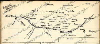
- Sketch map captioned French Advance, showing the Western Front around Reims, France, April 1917D/DLI 7/63/2(190)
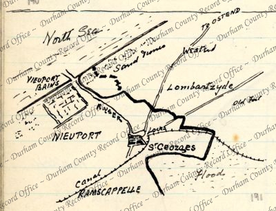
- Sketch map of Nieuport, Belgium, c.1917D/DLI 7/63/2(191)
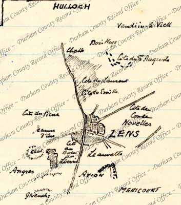
- Sketch map of Lens and environs, France, c.1917D/DLI 7/63/2(192)
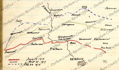
- Colour sketch map of Verdun and environs, France, c.1917D/DLI 7/63/2(193)
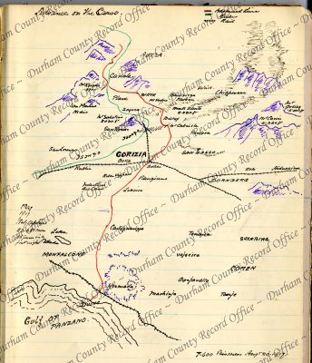
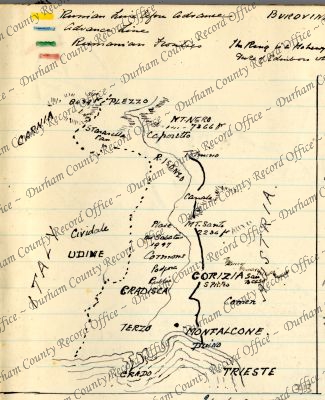
- Colour sketch map captioned Advance on the Carso, showing a section of the Southern Front around Gorizia and the Isonzo River, Austria, c.1917D/DLI 7/63/2(194)
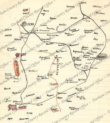
- Colour sketch map of a section of the Western Front from Arras to Lens, France, c.1917D/DLI 7/63/2(195)
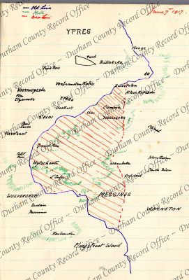
- Colour sketch map of the Messines Ridge, 7 June 1917D/DLI 7/63/2(196)
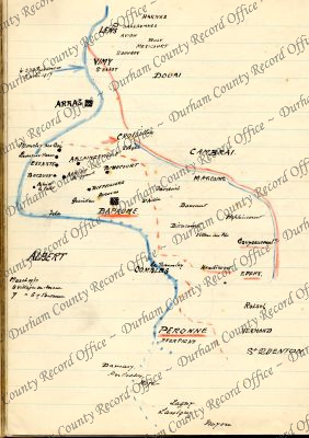
- Colour sketch map of a section of the Western Front from Peronne to Lens, France, 1917D/DLI 7/63/2(197)
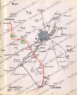
- Colour sketch map of St Quentin and environs, France, 3 April 1917D/DLI 7/63/2(198)
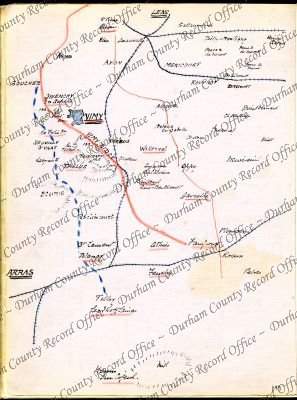
- Colour sketch map of a section of the Western Front between Arras and Lens, France, including Vimy Ridge, c.1917D/DLI 7/63/2(199)
- Colour sketch map of a section of the Western Front between Neuville and Vermand, France, c.1917D/DLI 7/63/2(200)
- Colour sketch map of a section of the Western Front around Puisieux, France, 25 February 1917D/DLI 7/63/2(201)
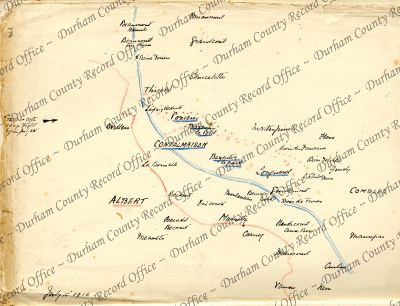
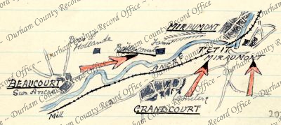
- Colour sketch map of Beaucourt, Grandcourt and Miraumont, France, 19 February 1917D/DLI 7/63/2(202)
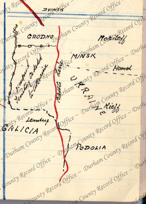
- Colour sketch map of the Eastern Front, c.1917D/DLI 7/63/2(203)
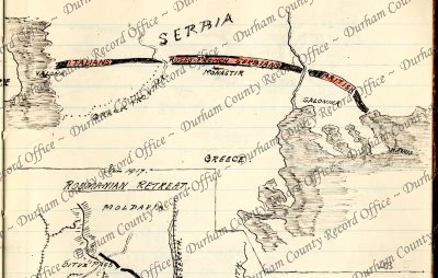
- Sketch map captioned Roumanian Retreat, showing a section of the Eastern Front around Braila, Rumania, January 1917D/DLI 7/63/2(204)
- Sketch map of Kut [Mesopotamia], 1917D/DLI 7/63/2(205)
- Sketch map of Verdun and environs, France, October 1916D/DLI 7/63/2(206)
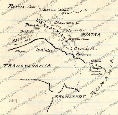
- Sketch map of a section of the Eastern Front in Transylvania and the Carpathian Mountains, c.1916D/DLI 7/63/2(207)
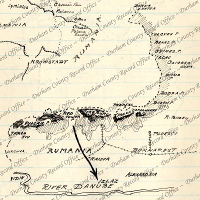
- Sketch map of Rumania, c.1916D/DLI 7/63/2(208)
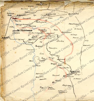
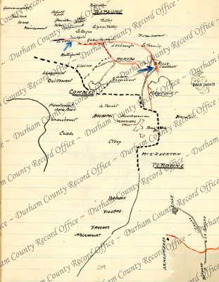
- Colour sketch map of a section of the Western Front around Combles, France, c.1916D/DLI 7/63/2(209)
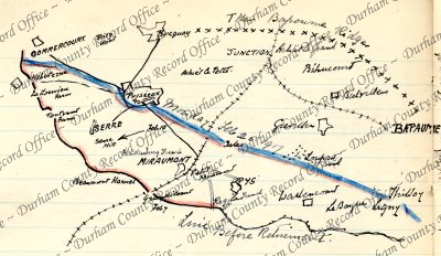
- Sketch map of the Battle of Bapaume, France, October 1916D/DLI 7/63/2(210)
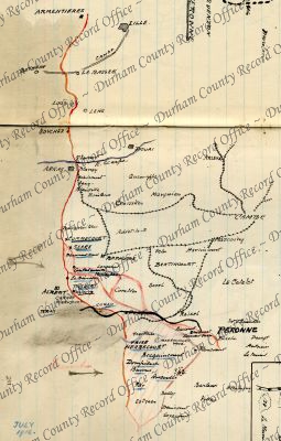
- Colour sketch map of a section of the Western Front between Armentieres, and Peronne, France, July 1916D/DLI 7/63/2(211)
- Colour sketch map of the Eastern Front, 1917D/DLI 7/63/2(212)
- Sketch map of the Italian - Austrian border, c.1917D/DLI 7/63/2(213)
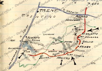
- Colour sketch map captioned The Italian Drive, showing a section of the Eastern Front around Trent, Austria-Hungary, 1916 - 1917D/DLI 7/63/2(214)
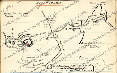
- Colour sketch map of Mesopotamia, showing the position of Kut on the River Tigris, c.1916D/DLI 7/63/2(215)
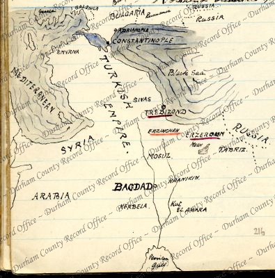
- Colour sketch map of the Turkish Empire, showing the position of Baghdad, 1916D/DLI 7/63/2(216)
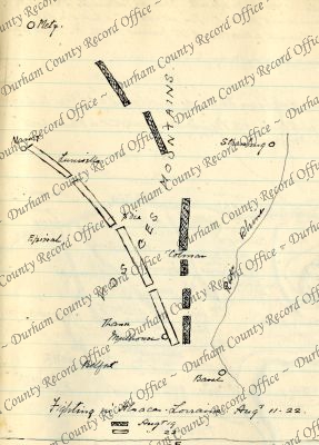
- Sketch map captioned Fighting in Alsace - Lorraine, showing a section of the French - German border, c.1914D/DLI 7/63/2(217)
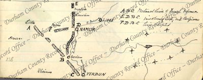
- Sketch map of a section of the Western Front between Verdun, France, and Liege, Belgium, c.1914 - 1918D/DLI 7/63/2(218)