Your search found 17450 photographs. Click to jump to detailed information about a particular catalogue entry. Not what you were looking for? See our search tips or search the catalogue again.
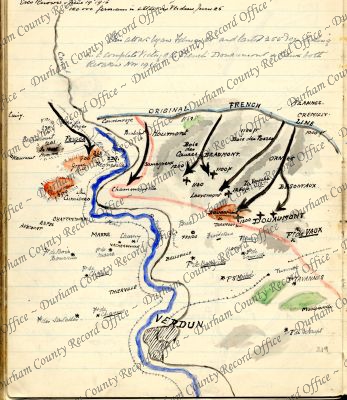
 Colour sketch map of a section of the Western Front around Verdun, France, 1916D/DLI 7/63/2(219)
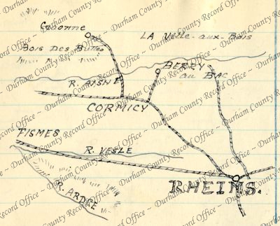
- Sketch map of a section of the Western Front around Reims, France, c.1914 - 1918D/DLI 7/63/2(220)
- Sketch map of a section of the Western Front around Saint Eloi, Belgium, c.1914 - 1918D/DLI 7/63/2(221)
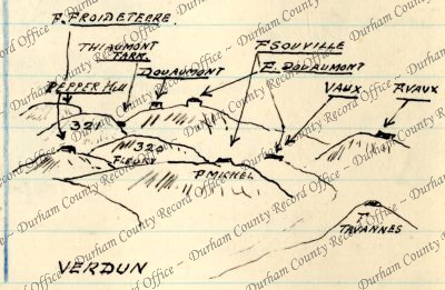
- Sketch map showing the position of forts near Verdun, France, c.1914 - 1918D/DLI 7/63/2(222)
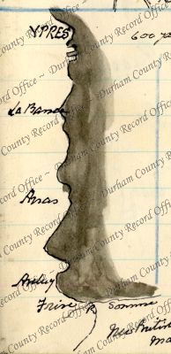
- Sketch map of a section of the Western Front between Ypres, Belgium, and the Somme, France, 1916D/DLI 7/63/2(223)
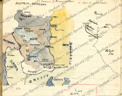
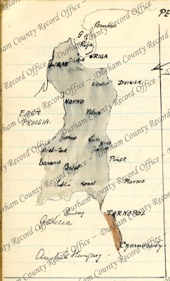
- Colour sketch map of the Eastern Front, c.1914 -1918D/DLI 7/63/2(224)
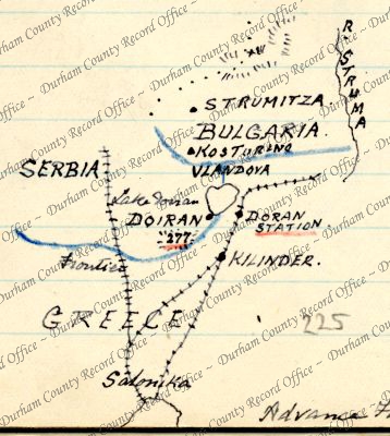
- Sketch map of a section of the Serbo - Greek frontier around Doiran, c.1916D/DLI 7/63/2(225)
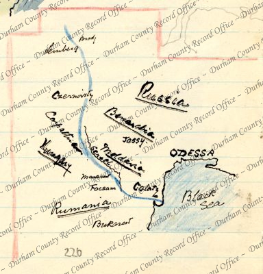
- Colour sketch map of the Romanian - Russian border, c.1916D/DLI 7/63/2(226)
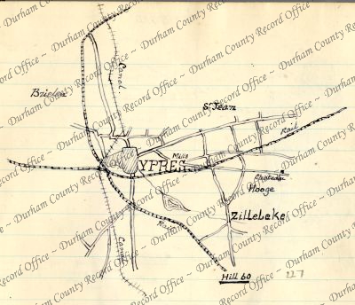
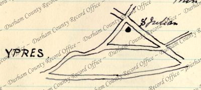
- Sketch map of Ypres and environs, Belgium, c.1914 - 1918D/DLI 7/63/2(227)
- Sketch map of Ypres, Belgium, showing the position of soldiers' graves, c.1915 - 1918D/DLI 7/63/2(228)
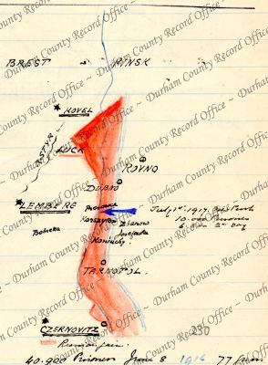
- Colour sketch map of a section of the Eastern Front between Riga, Livonia, Russia, and Czernovitz, Austria-Hungary, c.1914 - 1917D/DLI 7/63/2(229)
- Colour sketch map showing the area of Austria-Hungary invaded by Russia, c.1917D/DLI 7/63/2(230)
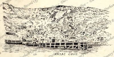
- Sketch of Anzac Cove, Turkey, c.1915D/DLI 7/63/2(231)
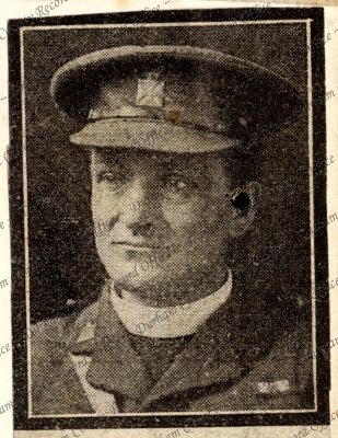
- Photograph, from a magazine, of Brigadier-General, Reverend John Morrow Simms, c.1914 - 1918D/DLI 7/63/2(232)
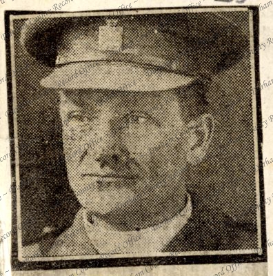
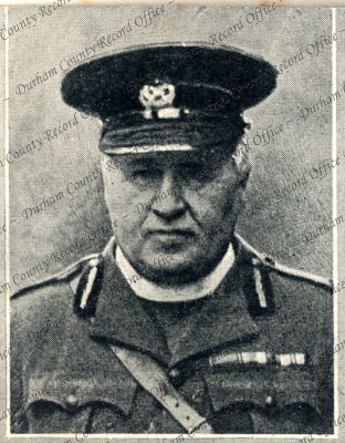
- Photograph, from a newspaper, of Reverend R. Bayley Hardy, Victoria Cross, c.1916D/DLI 7/63/2(233)
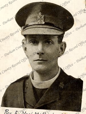
- Photograph, from a magazine, of Reverend E. Noel Mellish, Victoria Cross, c.1915D/DLI 7/63/2(234)
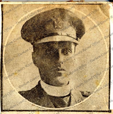
- Photograph, from a newspaper, of Reverend W.R.F. Addison, Victoria Cross, c.1914 - 1918D/DLI 7/63/2(235)
- Duplicate of D/DLI 7/63/2(233)D/DLI 7/63/2(236)
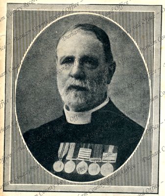
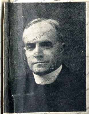
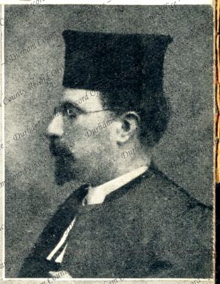
- Photograph, from a magazine, of Reverend Canon E.H. Pearce, c.1914 -1918D/DLI 7/63/2(237)
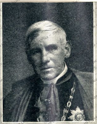
- Photograph, from a magazine, of Bishop Taylor-Smith, Chaplain-General to the Forces, c.1914 - 1918D/DLI 7/63/2(238)
- Photograph, from a magazine, of Monsignor Bickerstaffe-Drew, c.1914 - 1918D/DLI 7/63/2(239)
- Photograph, from a magazine, of Reverend Doctor Michael Adler, c.1914 - 1918D/DLI 7/63/2(240)
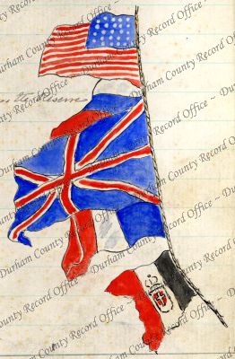
- Colour sketch of the flags of the United States of America, Russia, the United Kingdom, France, and an unidentified country, c.1917D/DLI 7/63/3(1)
- Sketch plan of coastal fortifications at Seaton Sluice, c.1914D/DLI 7/63/3(2)
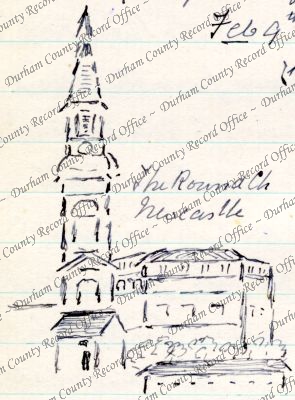
- Sketch captioned The Round Ch Newcastle, c.1914D/DLI 7/63/3(3)
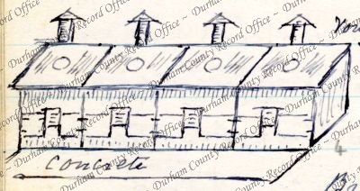
- Sketch of kitchen huts, c.1914D/DLI 7/63/3(4)
- Sketch map of farmland near the Ponteland Road [possibly in Northumberland], c.1914D/DLI 7/63/3(5)
- Sketch map showing the position of Ravensworth Castle, c.1914D/DLI 7/63/3(6)
- Sketch plan of a camp, c.1915D/DLI 7/63/3(7)
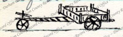
- Sketch of a three wheeled cart, c.1915D/DLI 7/63/3(8)
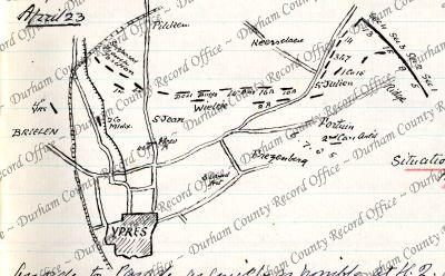
- Sketch map captioned 'Situation at 7 a.m.', showing Ypres, and environs, Belgium, 23 April 1915D/DLI 7/63/3(9)
- Sketch of a motor transport vehicle, c.1915D/DLI 7/63/3(10)
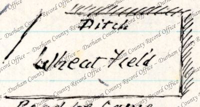
- Sketch map of a wheat field, c.1915D/DLI 7/63/3(11)
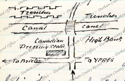
- Sketch map showing the position of a Canadian nursing station near Ypres, Belgium, c.1915D/DLI 7/63/3(12)
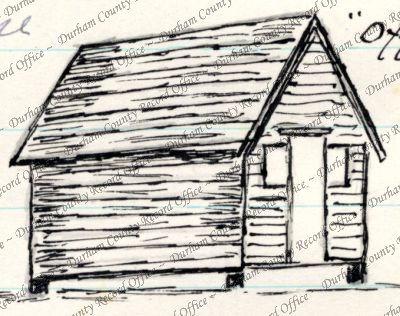
- Sketch of a hut, c.1915D/DLI 7/63/3(13)
- Sketch plan of a camp, c.1915D/DLI 7/63/3(14)
- Sketch of an officers' hut, c.1915D/DLI 7/63/3(15)
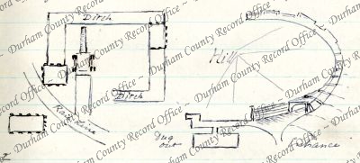
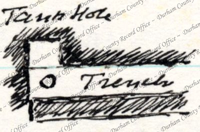
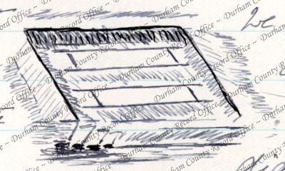
- Sketch plan of a trench, c.1915D/DLI 7/63/3(16)
- Sketch plan of trenches, c.1915D/DLI 7/63/3(17)
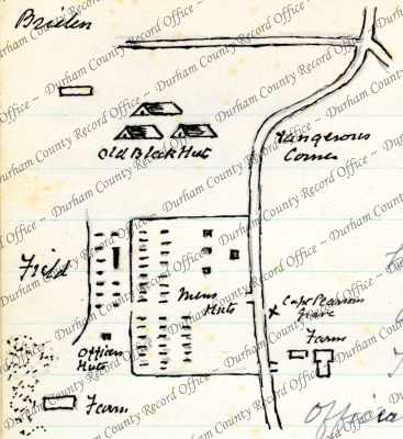
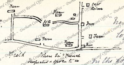
- Sketch map of farmland, showing the position of a camp, c.1915D/DLI 7/63/3(18)
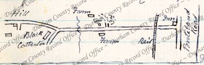
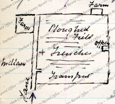
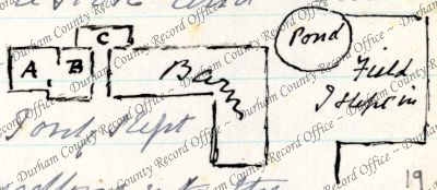
- Sketch plan of a farm, c.1915D/DLI 7/63/3(19)
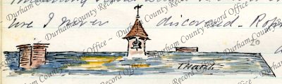
- Colour sketch of a thatched roof, c.1915D/DLI 7/63/3(20)
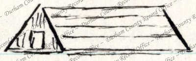
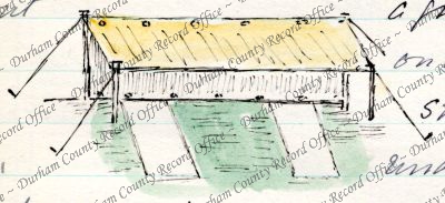
- Colour sketch of a bivouac, c.1915D/DLI 7/63/3(21)
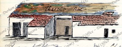
- Colour sketch of a barn with a thatched roof, c.1915D/DLI 7/63/3(22)
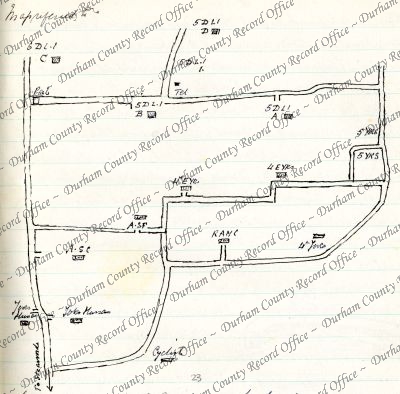
- Sketch plan of a camp, c.1915D/DLI 7/63/3(23)
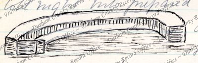
- Sketch of a trench, c.1915D/DLI 7/63/3(24)
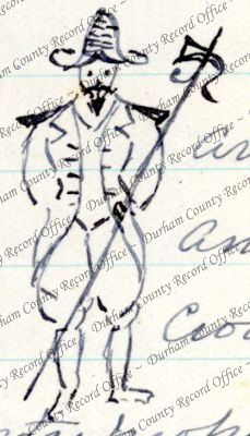
- Sketch of a soldier in historic uniform, c.1915D/DLI 7/63/3(25)
- Sketch of two stretchers on the bottom of a dug out, c.1915D/DLI 7/63/3(26)
- Sketch map of trenches beside a farm, c.1915D/DLI 7/63/3(27)
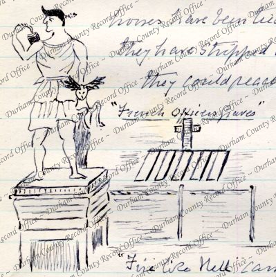
- Sketch of a monument and the graves of French officers, c.1915D/DLI 7/63/3(28)